AI Scientist – Geospatial & Remote Sensing

Yili Yang | AI & Machine Learning for Complex Global Systems.

Geoscience

Data Science

Featured project

Leading a pan-Arctic thaw-slump DL system from data collection to deployment

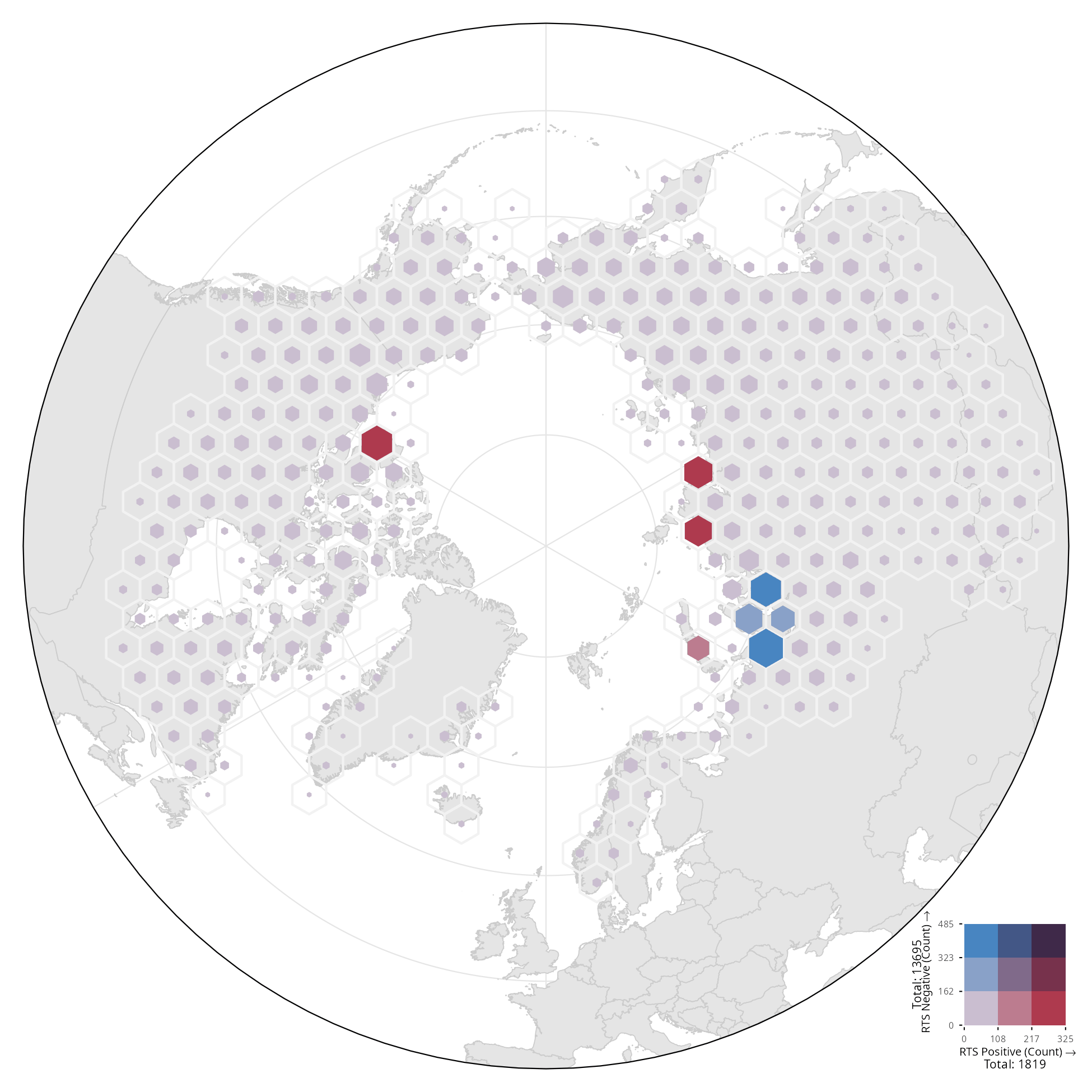
RTSmapping v2 detects retrogressive thaw slumps — the most dramatic form of abrupt permafrost thaw — in 4.8 m PlanetScope basemap imagery. One scientist designed the dataset, trained and audited the models, benchmarked them against 6.7B-parameter foundation encoders, and deployed a 32-GPU fleet that swept the entire circumpolar Arctic (50–76°N) — delivering an open, DOI-citable map of 19,068 quality-controlled thaw slumps.

Circumpolar Arctic · 19,068 mapped thaw slumps · live Earth Engine app Open in Earth Engine ↗
41.6M satellite tiles inferenced · circumpolar Arctic
0.94 PR-AUC · 3-seed ensemble, validation
40 GPUs 32× L4 inference fleet + 8× A100 training
19,068 high-confidence slumps · 529.7 km²

01 · Science

Referee-proof by design

Leakage-free spatial splits, three-seed ensembles, object metrics corrected to the minimum mapping unit, and a full pre-launch audit. Benchmarked head-to-head against SAM2 and satellite foundation models up to 6.7B parameters — the purpose-built 30M-parameter UNet++ wins at a fraction of the compute.

PR-AUC — UNet++ 0.92 · ViT-L 0.92 · 7B frozen 0.76 · SAM2 0.56
02 · Engineering

Planetary-scale inference

An atomic shard-claim queue on cloud storage drove a self-healing fleet of 32 L4 GPUs through 41,567,572 tiles with exactly-once reconciliation — every tile accounted for. Docker-reproducible end to end, with a 338-test suite guarding the pipeline.

2,079 shards · 0 tiles lost · 338 tests green

03 · Product

From pixels to open maps

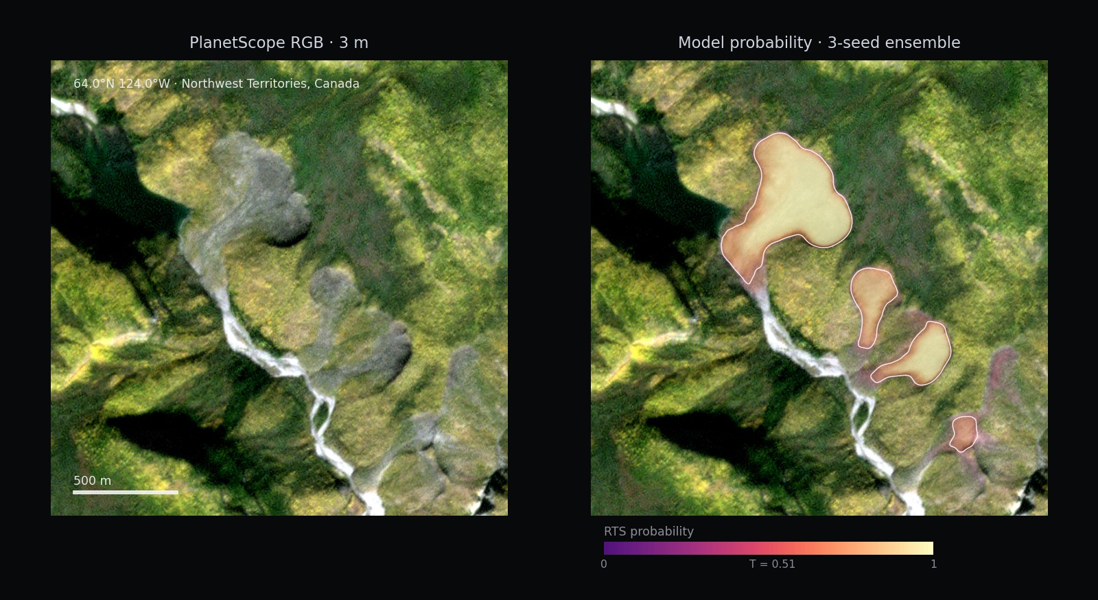
Example model output: PlanetScope RGB tile beside the same tile with the model's thaw-slump probability heatmap and decision-threshold contours overlaid

Model output on 2025 imagery — Northwest Territories, Canada

19,068 high-confidence polygons across 529.7 km² — drawn from 60,167 candidates at threshold 0.30 — released as open vectors and cloud-optimized rasters, citable at doi:10.18739/A26970107. Builds on the open ARTS benchmark (Scientific Data) and deep-learning mapping in RSE.

NSF Arctic Data Center · cloud-optimized GeoTIFF · open access

Skills
Tools & Environments

Tools & Environments

Claude Code
VS Code
Git
GitHub
Google Colab
Jupyter
GCP
Overleaf
Google Earth Engine
ArcGIS
QGIS
PyTorch
Docker
Linux
Thoughts & projects
Publications
Live academic metrics

Experience

Collaborations